Make the most of your Dental Benefits,
Call for an Appointment Today!
Bright & Beautiful
Smiles
for the Whole Family
1625 Sunnyfield Dr., Goshen, IN
574.534.5528 •
Goshen Family Dentistry
Dr. Cheryl Carlton • Dr. Mark Deal
4024 Elkhart Rd. Suite 1 Goshen, IN 46526
574.875.7099
Life is better
in the club.
Sam’s Club Membership
Whether you’re an individual or a business, a Sam’s Club Membership
more than pays for itself. With exclusive savings on the things you need,
the things you love, and on all sorts of unexpected things. And don’t
forget, Sam’s Instant Savings in addition to all that. Sign up today, and
see how much better it is in the Club.
Hours:
Tues-Fri 5am-4pm
Sat 5am-2pm
Call ahead on orders for
Cream Pies and larger
amounts.
Customer Appreciation Days!
Friday, April 17, 5 am-4 pm • Saturday, April 18, 5am-2 pm
59162 CR43
Middlebury, IN 46540
- Just 1 1/4 miles south of US 20 -
Phone: (574) 825-7918
Fax: (574) 825-0209
T
h
e
B
e
s
t
i
n
B
a
k
e
d
G
o
o
d
s
Country Lane Bakery
Since 1996
Cookies • Pies • Breads • Sweet Rolls • Cakes
No Preservatives Added
Now In Season!
Fresh Strawberry Pie
Strawberry Rhubarb Pie
Specials For Customer Appreciation!
Save 10% on All Sales!
Buy $50
and get 1/2 Doz Cookies
FREE!
Refreshments!
We will have Turkey Breast Sandwiches
featuring our Home Made Breads only
April 17, 10-3, and April 18, 10-2
Both Days Free Sweet Roll
and Coffee All Day!
Stop in for our Weekly
Specials Any Time!
Introducing a New Cookie
Each Week, and Much More!
Sign Up For Door Prizes
Each Day!
GRAND PRIZE
Win Your Choice of 1 Dozen Sweet
Rolls or a Pie Each Month For a Year!
P
alm
S
unday
T
ornadoes
| 50
th
A
nniversary
The Goshen News Saturday, April 11, 2015 |
29
“Conditions were favor-
able for the development of
large, long-lived, rotating
thunderstorms called su-
percells,” Call said. “Super-
cells are the most intense
form of thunderstorm and
capable of producing large
hail, strong wind gusts and
tornadoes.”
Call said that 99 percent of
thunderstorms are ordinary
and produce rain, some
lighting and the spring and
summer showers that water
Indiana’s corn crop each
year.
“Supercells only form
when we have a lot of twist-
ing and turning of the wind
with height in the atmo-
sphere and conditions are
favorable to the formation
of thunderstorms. Often we
are missing one or more of
the necessary ingredients,”
he added.
Lewis said when condi-
tions are right, storms can
form along the same path,
over and over.
“What we saw in Dunlap
was the family, or parallel
mode,” he said. “In this case
you end up with a tornado
forming along the path of
the storm. So, one tornado
forms and is then followed
by another... Generally
what happens in that type
of environment is the storm
forms but the atmosphere
doesn’t modify enough, so
you have the development
of additional thunderstorms
in that same environment.
So you can see those storms
form and another develop
in the same general area ...
In ‘65 that is what we were
seeing.”
Supercell storms are
immense, often towering
to more than 40,000 feet,
according to Lewis.
“Once you get into that,
you are dealing with jet
stream winds,” he said. “If
you push the clouds away,
it allows the sun to work on
the ground below. You are
able to take the moisture
and heat and evacuate it out
of the top of this storm and
allow the sun to work on
the ground below and keep
it going ... You create an
engine.”
So why doesn’t every
thunderstorm end up creat-
ing a supercell? Lewis said
supercells require a hori-
zontal column of air. Most
thunderstorms have a tilt to
their air currents.
“... the updraft and
downdraft get tilted so the
downdraft can push but the
updraft just rides over it
and they end up just sort of
riding over the top of each
other,” he said.
And why do most people
who saw the tornado out-
break that day say the sky
looked strange, with yellow
and green light?
Lewis said the light was
filtered through a lot of
clouds.
“It was a deep, deep storm
system,” he said.
Tornado alley
Occasionally locals are
heard to say they live in
tornado alley. Do we? The
answer depends on what
map you consult and what
expert you talk to.
“We certainly are not the
Southern Plains,” Lewis
said. “But we have a ten-
dency to see more torna-
does here than in Michigan
or even the Northeastern
states.”
Fortunately, not all torna-
does in northern Indiana are
in the F3 or F4 categories.
Lewis said most of the tor-
nadoes reported here, are
much smaller.
“But (they are) just as
deadly, just as dangerous.
They are a threat to lives
and a threat to property,”
Lewis said.
Lewis said “Tornado Al-
ley” is generally outlined as
starting in Texas and taking
in the Plains states and hav-
ing just its northern edge
enter north central Illinois
and northern Indiana.
“Tornado Alley is gen-
erally thought of as the
Great Plains, and over long
periods of time this is where
the most tornadoes have
occurred,” Call said. “How-
ever, the Midwest and Deep
South are two other regions
that also get an above aver-
age number of tornadoes.
In any given year they may
actually be more active than
the Great Plains.”
According to the National
Oceanic and Atmospheric
Administration statistics, In-
diana averaged 22 tornadoes
a year from 1991 to 2010.
Texas topped all states with
an average 155 tornadoes.
Kansas had an average of 96
twisters and Arkansas aver-
aged 62.
Disaster
Continued from page 4
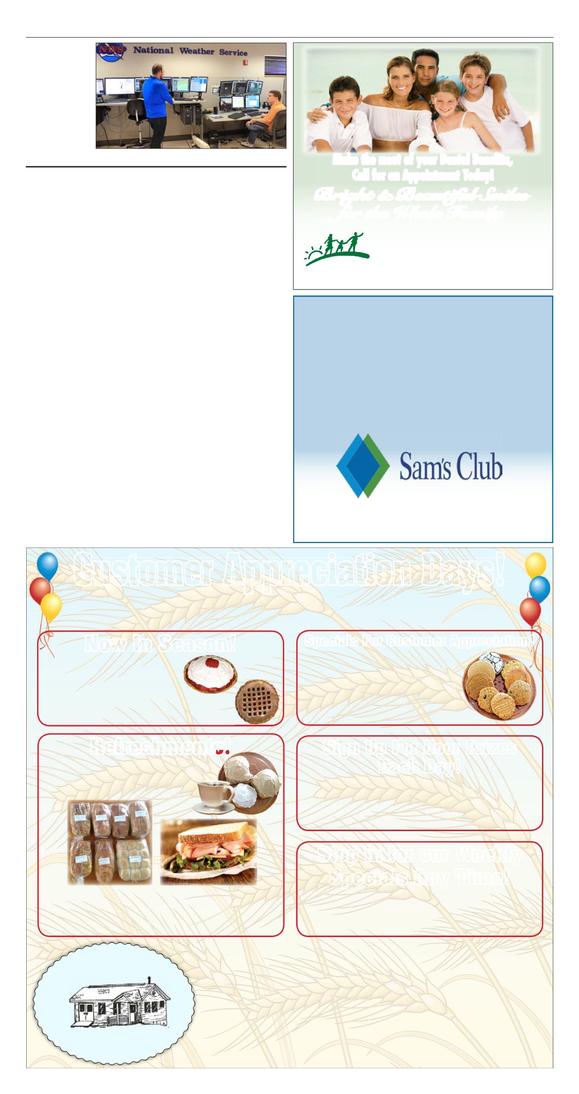
NICHOLAS
GREENAWALT
,
left, and Nathan
Marsili, work their
shifts at the North
Webster National
Weather Service of-
fice. The office staff
uses a Doppler ra-
dar to track storms
as they move into
northern Indiana,
southern Michigan
and northwest Ohio.
Roger Schneider |
The Goshen News


